
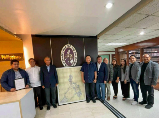
FORMER Supreme Court Senior Associate Justice Antonio Carpio turned over to the Integrated Bar of the Philippines (IBP) a replica of an 1875 map showing the Philippine Archipelago that was published in Madrid by the Spanish government. The donation was accepted by the IBP through the 26th Board of Governors (BoG) led by National President Antonio Pido on Sep. 9.
Justice Carpio explained that the map shows all the islands, shoals, and rocks forming part of the Philippine archipelago during the Spanish regime. He added that this map, which is called the “1875 Carta General del Archipelago Filipino,” was used by the United States (US) government as a reference with respect to territory ceded by Spain to the United States as contemplated under the Treaty of Paris of 1898 and as clarified by the Treaty of Washington of 1900.
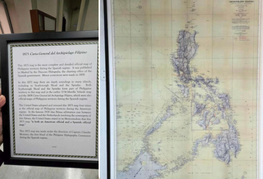
The map was adopted and re-issued by the United States four (4) times as the official map of Philippine territory during the American regime, and the map is effectively the country’s title to all the islands, reefs, shoals, and rock formations contained therein. These include the Scarborough Shoal (Bajo de Masinloc) and all other reefs and shoals, including the Islands in the Spratlys that are mentioned on the map.
During the turn-over ceremonies, the BoG expressed the IBP’s appreciation for the donation and support for Justice Carpio’s position that the map is important documentary evidence relative to the Philippines’ claim of ownership over Scarborough Shoal (Bajo de Masinloc) and the Spratlys.